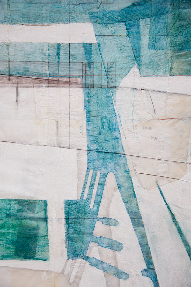


2013
Paint, ink, sketch paper overlaid on OS maps
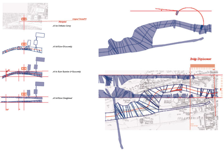
River Liffey unfolded and overlaid at Islandbridge Weir
The reconstructed map of the River Liffey forms a very small part of a larger study on the role of reason and intuition in the architectural design process, with specific reference to the reuse of existing urban landscapes. This small exercise was one of a series of drawing studies which reconsidered the manner in which designers document landscapes and its impact on their subsequent understanding and fluency in design.
The map describes the River Liffey tidal range from Islandbridge weir to the Poolbeg lighthouse in an effort to elucidate the underlying patterns of order residing in the surrounding urban fabric. The ordering begins with an understanding of the river flow, the tidal changes and the built elements that facilitate or interrupt this pattern in relation to the remainder of the city. It is incomplete and ever-evolving.
The study used, as source data in its construction, documentary photographs [approx 4000 from weir to lighthouse], OS maps from 1836 to present, UKHO Admirality Charts and associated publications, historical texts on the river development and data from Dublin Corporation Roads & Serices. Only a mid-section of the mapping is presented.